HarperCollins Publishers
HarperCollins Publishers Yorkshire Wolds Way : With Ordnance Survey Mapping
Best price incl. delivery
£14.98
£11.99 + £2.99 delivery
Prices range from £11.99 to £11.39 across 2 stores
Waterstones.com+£2.99 delivery
2 stores
BrandHarperCollins Publishers
EAN9780008780548
Compare prices
About this product
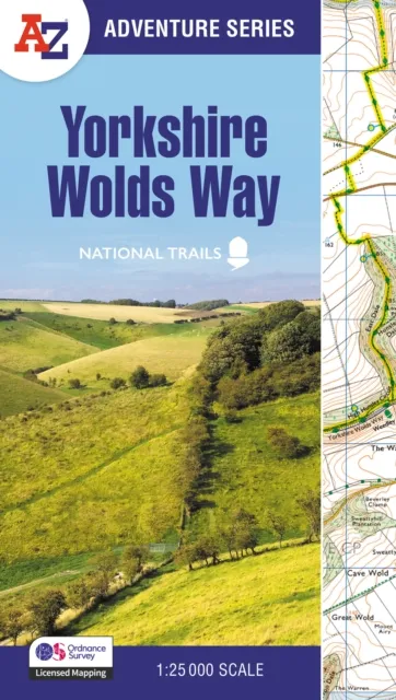
The A-Z Adventure Series of maps combines the best of OS and A-Z, creating the perfect companion for walkers, off-road cyclists, horse riders and anyone wishing to explore the great outdoors. The Yorkshire Wolds Way is a 79 mile (127 km) National Trail from the River Humber to the seaside resort of Filey.Crossing a tranquil landscape, the path encounters gently rolling chalk hills with easy climbs, isolated dry valleys, undulating fields and charming villages.The route on the map is clearly highlighted in yellow with mileage markers to gauge distances when planning sections of the walk to enjoy. This National Trail Map of the Yorkshire Wolds Way features 30 pages of continuous Ordnance Survey 1:25 000 mapping providing complete coverage of the Yorkshire Wolds Way.The atlas includes a route planner showing distances between places and the amenities available, featuring: Information CentresHotels/B&BsYouth HostelsCampsites (seasonal opening)Pubs, shops, restaurants, and cafes (seasonal opening)Petrol Stations Also featured is advice on safety and security when walking and the Countryside Code. Unlike the original OS sheets, this A-Z Adventure Atlas includes a comprehensive index to towns, villages, hamlets and locations, natural features, nature reserves, car parks and youth hostels, making it easy to find the required location quickly.Each index entry has a page reference and a six figure National Grid Reference.With a book size of 240mm x 134mm it is the same size as the standard OS folded map. Other National Trails available within the A-Z Adventure series include: Cotswold Way, Hadrian's Wall Path, Norfolk Coast Path & Peddars Way, Pembrokeshire Coast Path, Offa’s Dyke Path, South Downs Way, SW Coast Path, and Thames Path.
Price History (Last 30 Days)
Lowest Price Ever
£14.98
Waterstones.com · 20 May 2026
Highest Price
£15.38
Whsmith.co.uk · 2 May 2026
No price changes recorded yet — we’ll show changes here as prices move.


Frequently Asked Questions
What is the cheapest price for HarperCollins Publishers Yorkshire Wolds Way : With Ordnance Survey Mapping?
The cheapest price for HarperCollins Publishers Yorkshire Wolds Way : With Ordnance Survey Mapping is £14.98 (including delivery) from Waterstones.com.
How many stores sell HarperCollins Publishers Yorkshire Wolds Way : With Ordnance Survey Mapping?
We compare prices from 2 different UK stores to help you find the best deal for HarperCollins Publishers Yorkshire Wolds Way : With Ordnance Survey Mapping.
What is the price range for HarperCollins Publishers Yorkshire Wolds Way : With Ordnance Survey Mapping?
Prices for HarperCollins Publishers Yorkshire Wolds Way : With Ordnance Survey Mapping range from £11.99 to £11.39 across different retailers.
Independent price comparison·Prices updated regularly
CodeLand may earn commission from purchases made through our links, at no extra cost to you.