Ordnance Survey
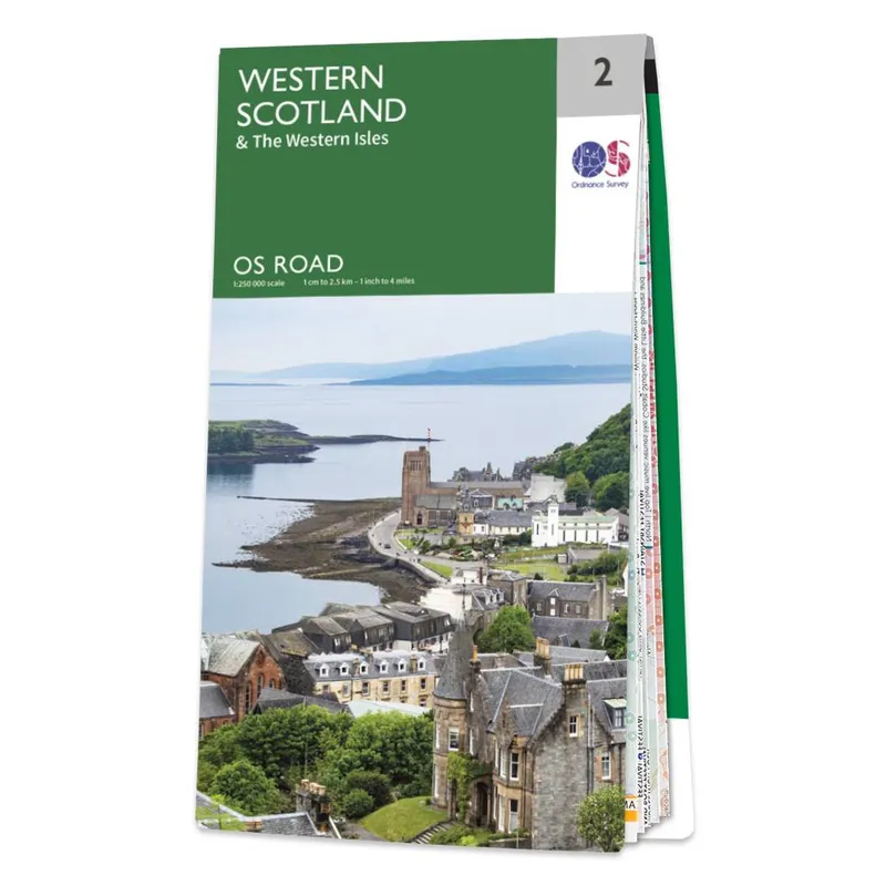
Ordnance Survey OS Map of Western Scotland: Road 2 - White
Best price incl. delivery
£7.99
Free delivery included
Prices range from £7.99 to £7.59 across 3 stores
Ordnancesurvey.co.ukFree delivery
3 stores
BrandOrdnance Survey
EAN9780319263747
Compare prices
About this product
The OS Road map of Western Scotland, is an essential companion on your next road trip to Scotland. Map winding roads from Dumbarton through sweeping western glens. Trace coastal routes edging lochs, cliffs, and rugged Atlantic shores. Navigate key locations including Oban, Ullapool, and Durness. Follow ferry connections linking Skye, Harris, and Lewis. Chart quiet island roads bordered by beaches and machair. Explore remote viewpoints shown clearly across each mapped isle. Drive iconic stretches carved between mountains and sea. Seek scenic lay bys marked for perfect west coast stops. Enjoy effortless planning across dramatic highland and island routes. Travel far and wide across Western Scotland’s wild beauty. Go on a journey that captures unforgettable coastal adventure. What's in OS Road 2: Western Scotland? Features Loch Lomond and the Trossachs National Park. Highlights key location, such as Isle of Lewis, North and South Uist, Isle of Mull, Isle of Skye and Jura. Covers towns and cities including Dumbarton, Tarbert, Fort William, Uig, Stornoway, Durness and Dingwall. Why an OS Road map? Our Road maps are perfect for road trips and holidays. Explore major roads, ferry crossings, toll bridges and key routes. Enjoy confidence knowing every journey is clearly laid out. Discover railway networks, stations, tourist information and landmark highlights. Spot national parks, scenic beaches and must‑see attractions with ease. Be prepared for detours, traffic and the unexpected. Prepare for breaks or quick day trips effortlessly. Choose the best routes to suit your travel style. Plan holidays with a road map designed for exploration. Perfect for planning, amazing for adventuring. Specifications: Edition: 2023 Publication Date: 16/05/2024 Map Format: Folded Physical Size - Folded: 24 x 1 x 13.4cm Physical Size - Unfolded: 127 x 95.5cm Sided Format: Single-sided Free Mobile Download: No Cover Image: Oban
Price History (Last 30 Days)
Lowest Price Ever
£7.99
Ordnancesurvey.co.uk · 20 May 2026
Highest Price
£11.58
Whsmith.co.uk · 28 Apr 2026
No price changes recorded yet — we’ll show changes here as prices move.
Frequently Asked Questions
What is the cheapest price for Ordnance Survey OS Map of Western Scotland: Road 2 - White?
The cheapest price for Ordnance Survey OS Map of Western Scotland: Road 2 - White is £7.99 (including delivery) from Ordnancesurvey.co.uk.
How many stores sell Ordnance Survey OS Map of Western Scotland: Road 2 - White?
We compare prices from 3 different UK stores to help you find the best deal for Ordnance Survey OS Map of Western Scotland: Road 2 - White.
Does Ordnance Survey OS Map of Western Scotland: Road 2 - White come with free delivery?
Yes! 1 of our partner stores offer free delivery on Ordnance Survey OS Map of Western Scotland: Road 2 - White.
What is the price range for Ordnance Survey OS Map of Western Scotland: Road 2 - White?
Prices for Ordnance Survey OS Map of Western Scotland: Road 2 - White range from £7.99 to £7.59 across different retailers.
Independent price comparison·Prices updated regularly
CodeLand may earn commission from purchases made through our links, at no extra cost to you.